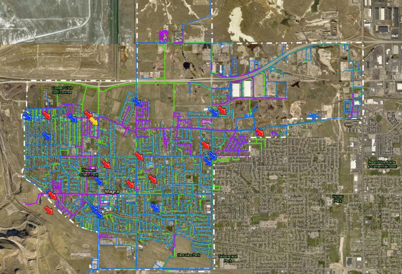
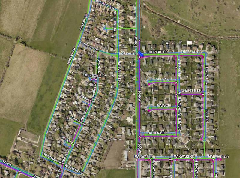
Epic Engineering was contracted by Magna Water and Sewer District to complete a detailed survey of all the culinary and secondary water, as well as sewer features throughout the town. Due to budget constraints the project was divided into different prioritized areas and survey work was completed in phases. Using established datum and customized data collection sheets, multiple survey crews collected data on each water valve, water meters, vault, pump station, tank, hydrant, etc. along with sewer manholes, lift stations, and other relevant infrastructure points.
Our GIS team used as-built drawings, active models, and other sources of information to develop an interactive online map of the water distribution and sewer collection networks with survey grade accuracy. This online map is used daily by District staff in the field to locate infrastructure. This digital model allows staff to identify utilities in their proximity and navigate to key features in all conditions. Not only can district staff see what infrastructure is around them, our GIS team linked all the as-built records to the online map, so staff can download as-builts for any asset in the system directly from the cloud. Not only can district staff see what infrastructure is around them, our GIS team linked all the as-built records to the online map, so staff can download as-builts for any asset in the system directly from the cloud.